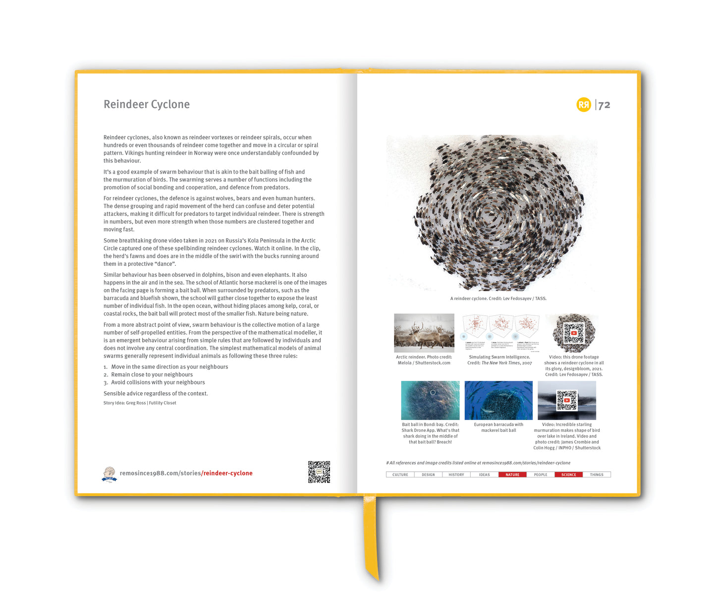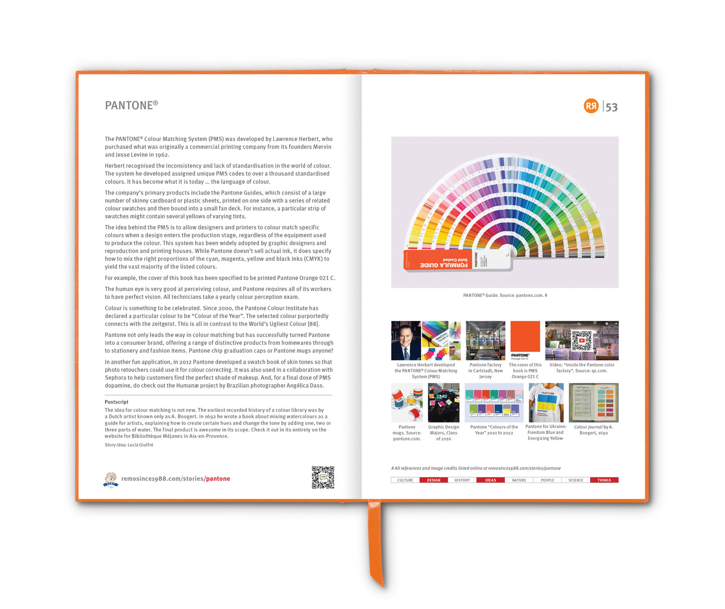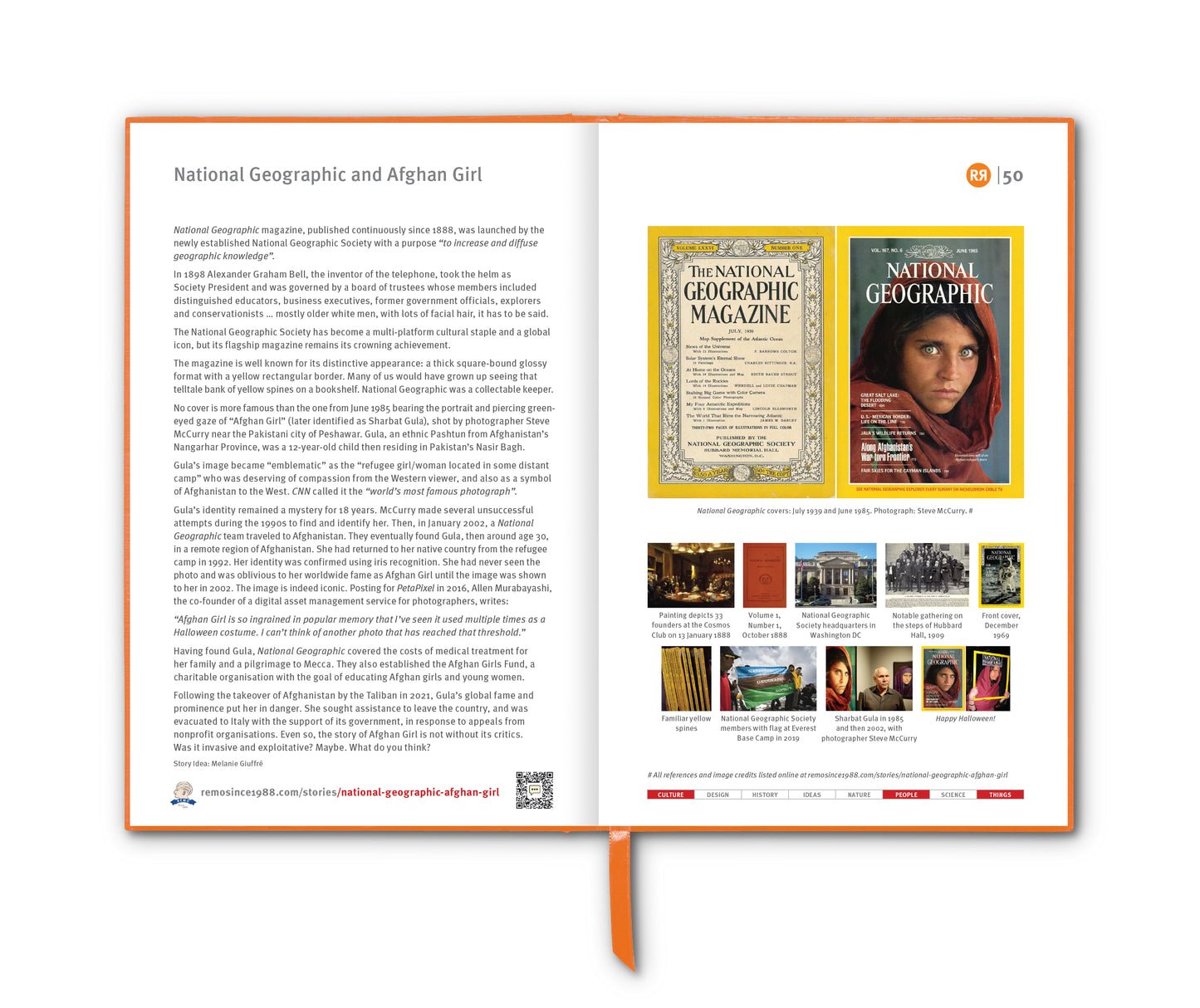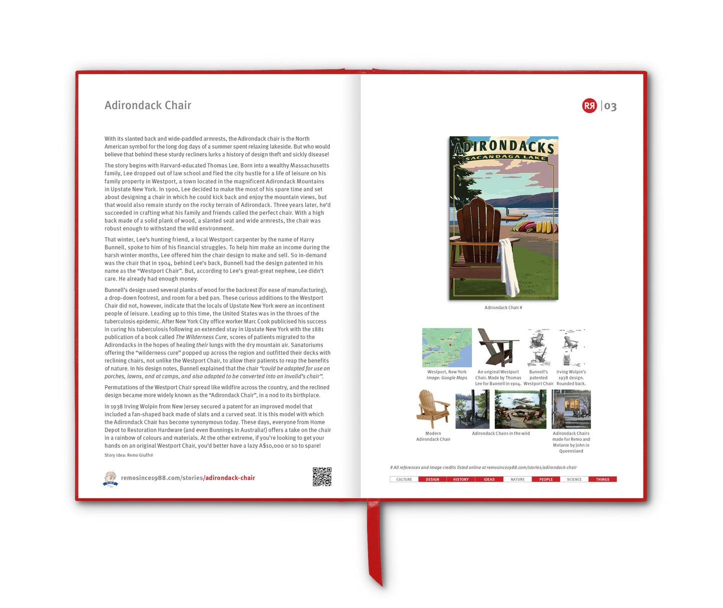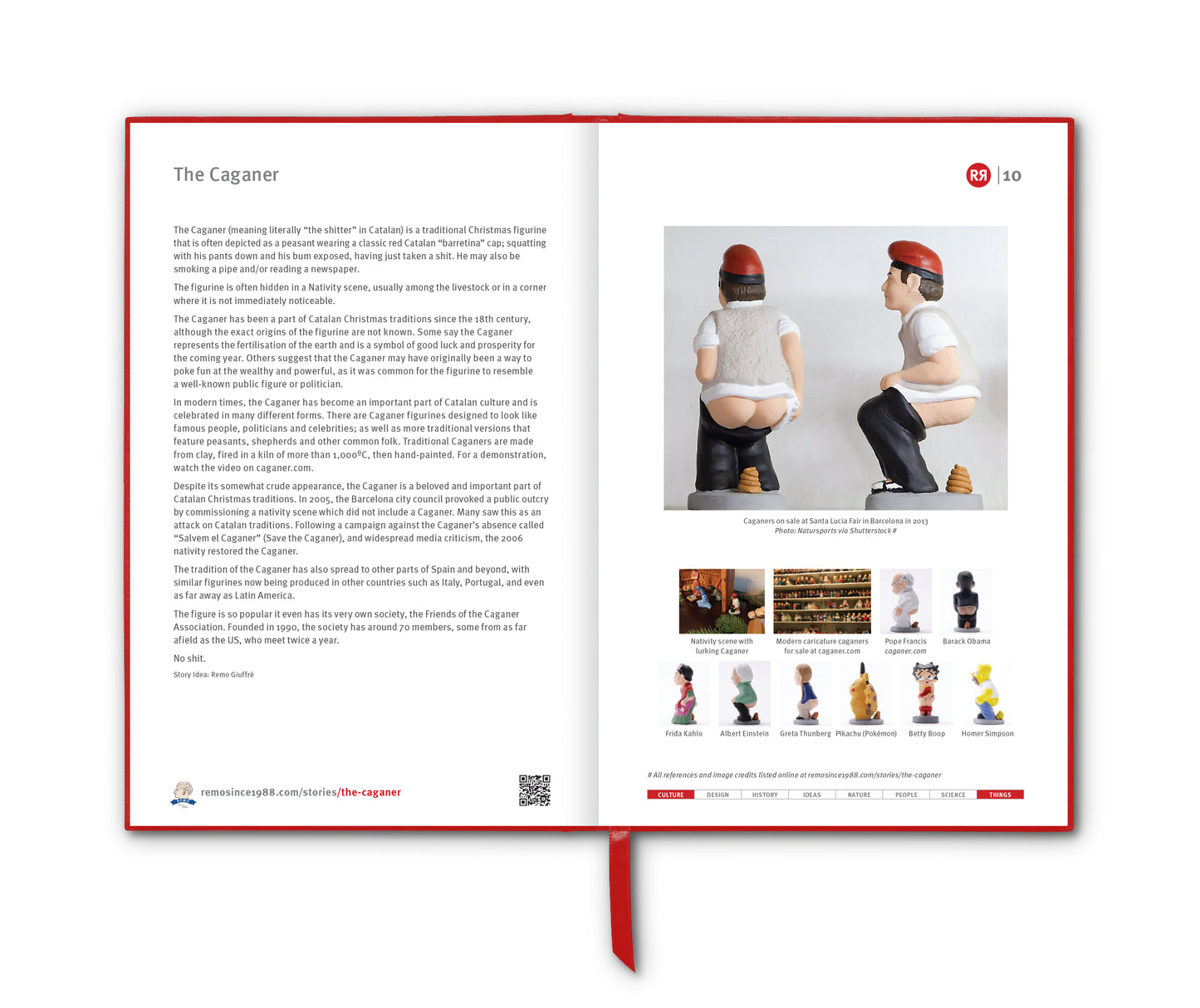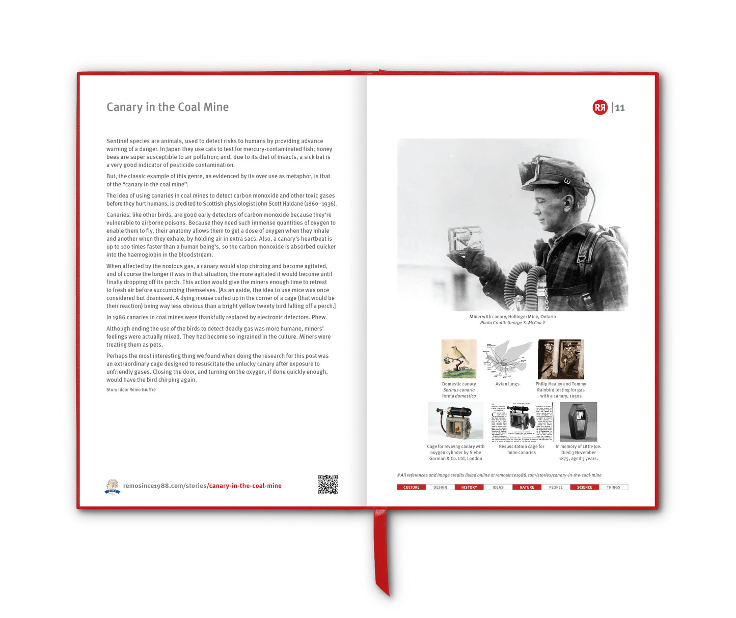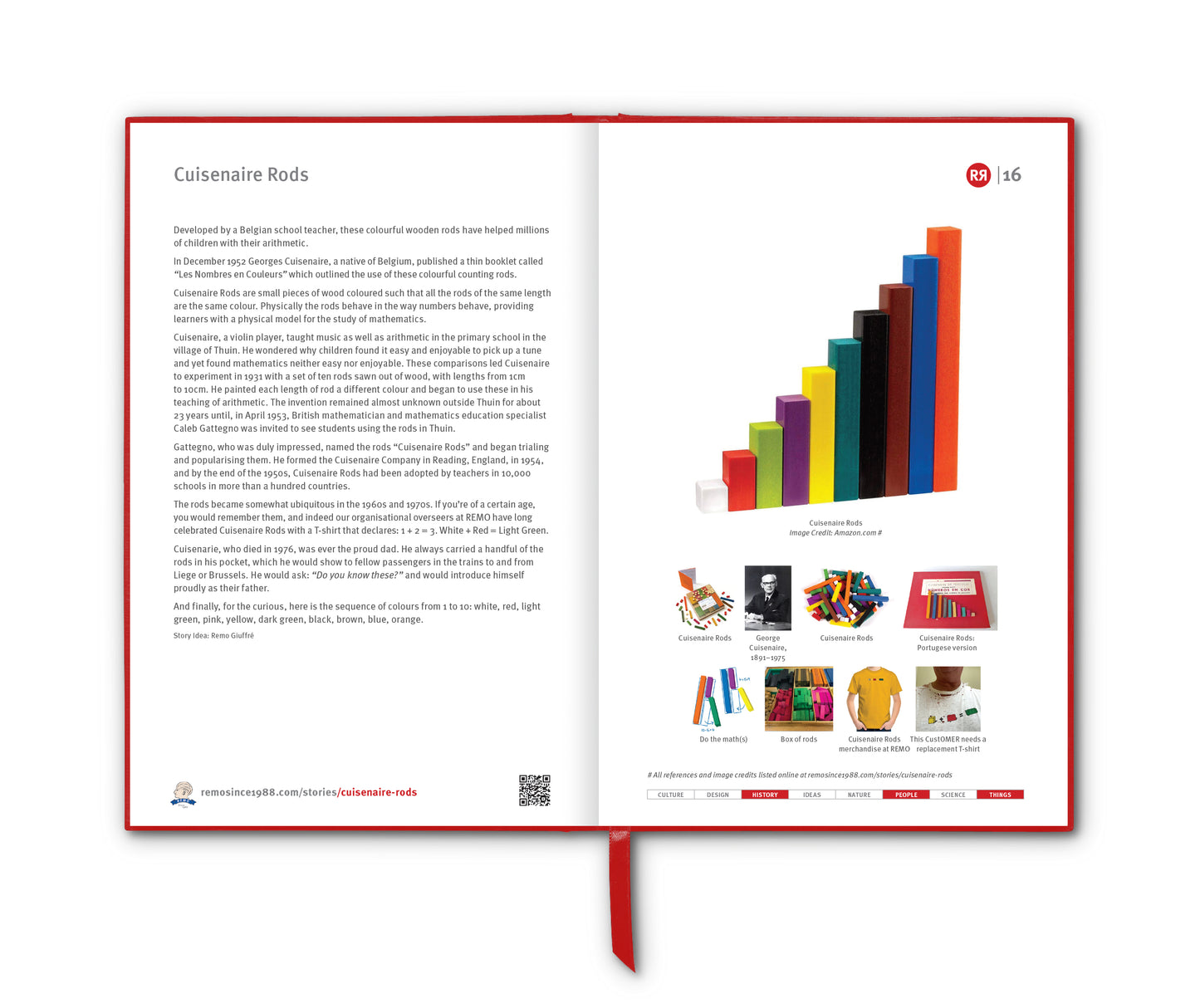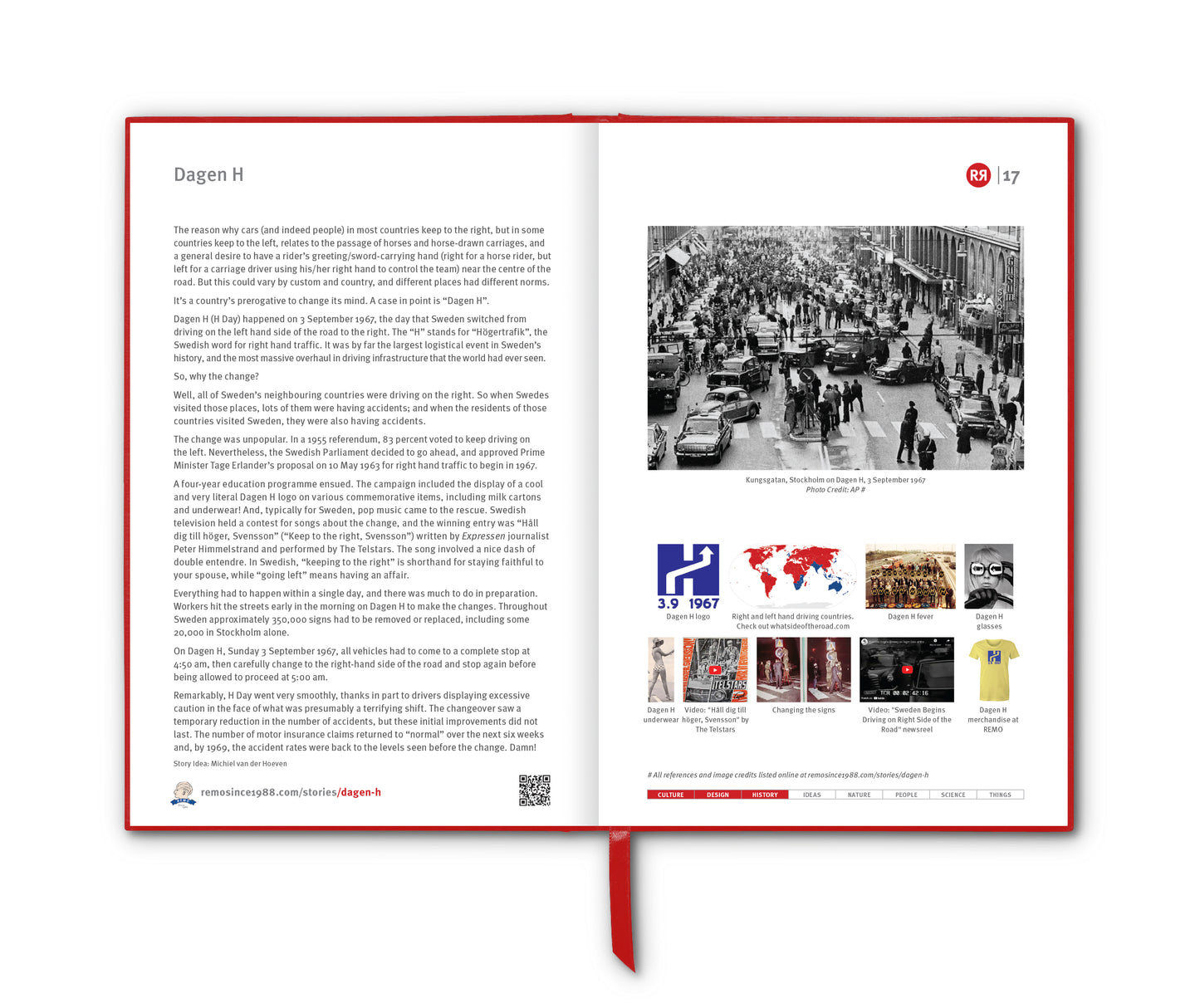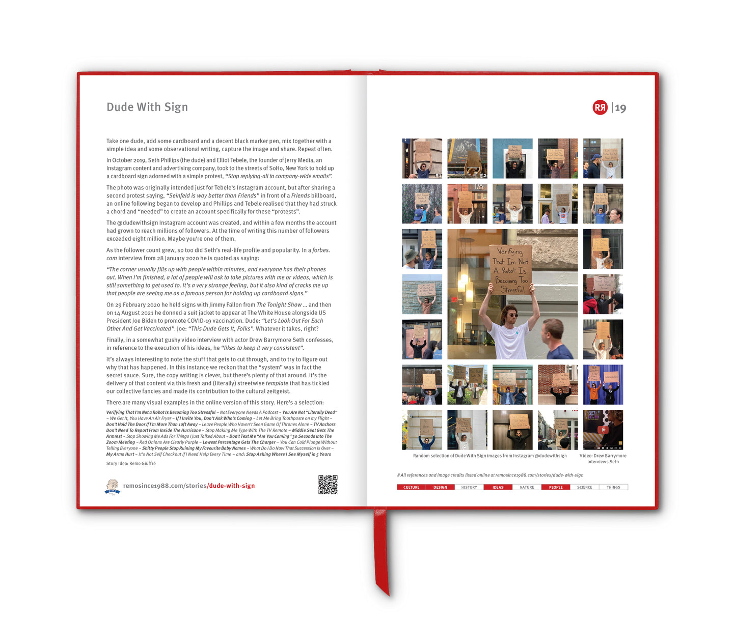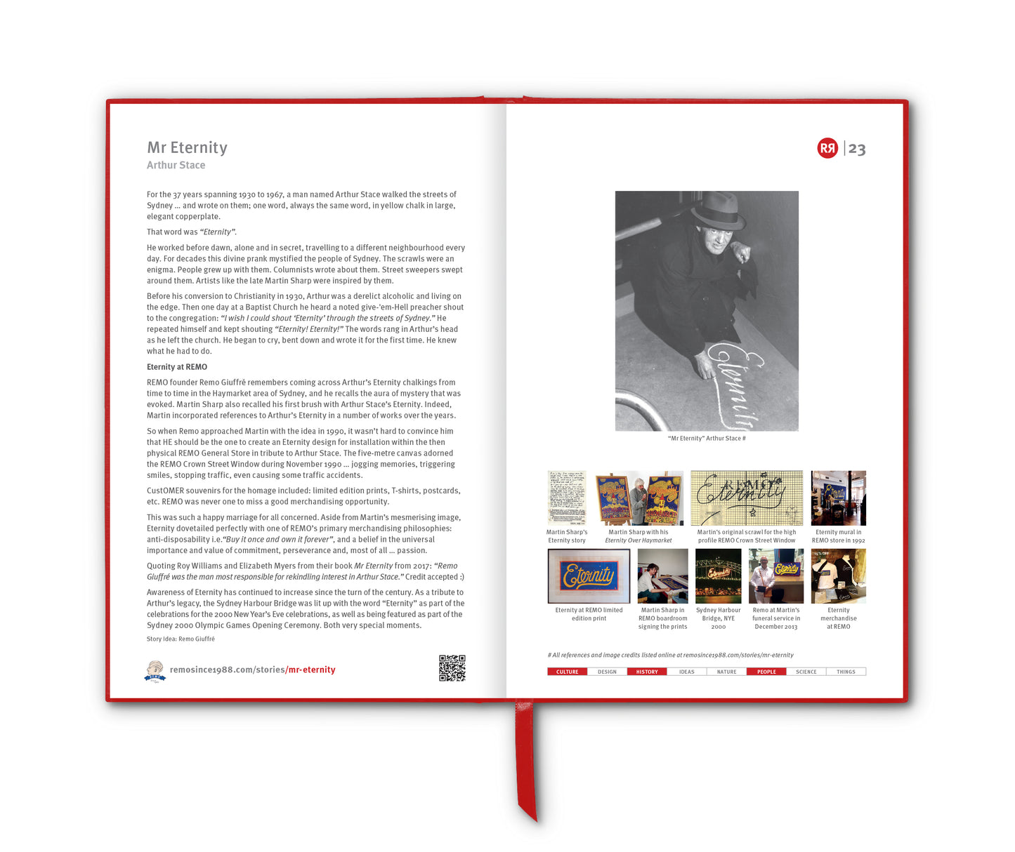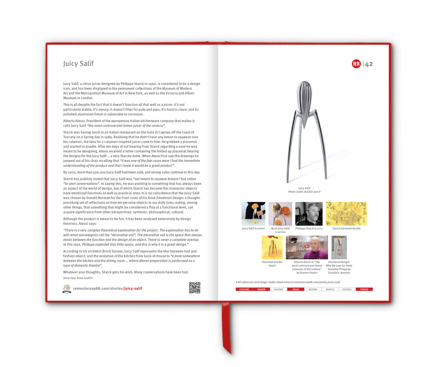

The Global Positioning System – better known as GPS – began not as a convenience for navigationally challenged drivers, but as a Cold War military tool.
Its origins trace back to the late 1950s, when scientists observed that radio signals from the Soviet satellite Sputnik 1 shifted frequency as it moved across the sky. This phenomenon, known as the Doppler effect, suggested that a satellite’s position could be determined from Earth. Crucially, the reverse was also true: if you knew the satellite’s position, you could determine your own location on the ground.
This insight led to early US Navy navigation systems like Transit in the 1960s, which allowed submarines to fix their positions. However, Transit was slow and limited. The modern GPS system began taking shape in 1973, when the US Department of Defense unified various satellite navigation efforts into a single program. Key figures included Bradford Parkinson, often called the “father of GPS”, who led the development of the system.
GPS became fully operational in 1995. It consists of a constellation of at least 24 satellites orbiting Earth, each continuously broadcasting signals that include the satellite’s position and the exact time the signal was sent. A GPS receiver – just like the one in your phone – calculates how long each signal took to arrive. Using the principle of trilateration, it determines its distance from multiple satellites. With signals from at least four satellites, the receiver can pinpoint its latitude, longitude, altitude and even the precise time.
Originally, GPS was intended strictly for military use – guiding missiles, coordinating troop movements and enabling precise navigation in all weather conditions. Civilian access was permitted in the 1980s, but with reduced accuracy through a feature called “Selective Availability”. This limitation was removed in 2000 by President Bill Clinton, dramatically improving civilian GPS precision and sparking widespread adoption.
Today, GPS is ubiquitous. It powers apps like Google Maps, Waze and what3words [RR2:86] enabling turn-by-turn directions and real-time traffic updates. It is essential for aviation, shipping, agriculture and emergency services. Farmers use GPS-guided machinery for precision planting; financial systems rely on GPS timing for synchronising transactions; wildlife researchers fit tiny GPS trackers to animals like elephants and sea turtles to map migration routes and combat poaching in real time; and ride-sharing platforms depend on it to match drivers with passengers.
Emergency services rely heavily on GPS as well. Ambulances and search-and-rescue teams can locate callers within metres, dramatically improving response times in critical situations. GPS has even found its way into sport. Elite runners and cyclists analyse performance data from GPS watches, while professional leagues use tracking systems to measure player speed, distance and positioning.
GPS has inspired a whole subculture of quirky, almost whimsical uses – many of them built on the simple idea of “where is it right now?” Pet tracking is the obvious one. Finally, artists have also embraced GPS in unexpected ways. The practice of “GPS drawing” involves recording your route while running or cycling to create giant images on a map. See Yassan’s Proposal [RR4:88] for a gold-medal example of this.
Like WiFi, GPS is one of those “what did we do without it” technological developments.
__________________________
References
https://en.wikipedia.org/wiki/Global_Positioning_System
Images
1. Artist's conception of GPS Block II-F satellite in Earth orbit
2. Sputnik 1, Sergei Korolev and Valentin Glushko on a 2007 Ukrainian stamp
3. How it works with signals from at least four satellites
4. USAF Colonel Bradford Parkinson in 1977
5. Attaching a GPS guidance kit to an unguided US Navy bomb, March 2003. Photo credit: Felix Garza Jr
6. Magellan Blazer12 GPS Receiver, 2005
7. GPS car navigation. Photo credit: Brecht Denil on Unsplash
8.
what3words [RR2:86] app
9.
Yassan and Netsuke with
Yassan’s Proposal [RR4:88]