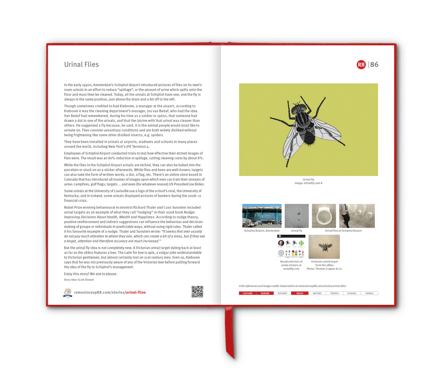
In the 19th century, before aerial photography, satellite imagery and climate science, large parts of the world were shaped not by knowledge but by imagination. Cartographers, explorers, and armchair theorists filled gaps in their maps with features that made sense to them – mountain ranges, rivers and speculative coastlines. But few mapped fictions lingered as stubbornly, or as influentially, as the idea that Australia contained a vast inland sea. And among its most enthusiastic champions was a man named Thomas J. Maslen, an English engraver, surveyor and thinker who helped fuel a geographical myth that endured for decades.
Maslen wasn’t a crank. He was an intelligent and well-read former East India Company clerk who had spent years studying landscapes and cultures abroad. When he turned his mind to Australia in the 1830s and 1840s, he was drawing on a popular assumption of the time: that large landmasses tended to contain large internal bodies of water. Africa had Lake Victoria; Asia had the Caspian and Aral Seas; North America had the Great Lakes. Surely, the reasoning went, this gigantic southern continent must hold something similar.
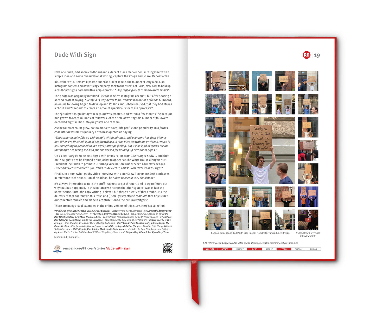
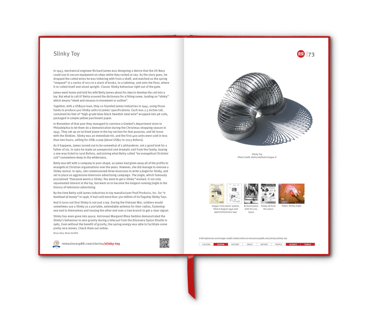
His influential 1830 publication The Friend of Australia laid out the case. Maslen studied the fragmentary maps available from coastal surveys and early expeditions and concluded that the uncharted interior was likely home to a huge navigable lake or sea. The 1827 map that he included in his book included whimsical names for parts of the continent, e.g. "Australindia " and "Anglicania" – and also depicted "The Delta of Australia" with "The Great River or the Desired Blessing" flowing west across the Northern Territory and discharging into the Indian ocean. [Ed: Healthy imagination indeed.] He even proposed where settlements should be built along the shores of the presumed sea, with carefully sketched-in towns, transportation routes and ports. His maps – half science, half creative writing – depicted an inland water system that looked invitingly logical.
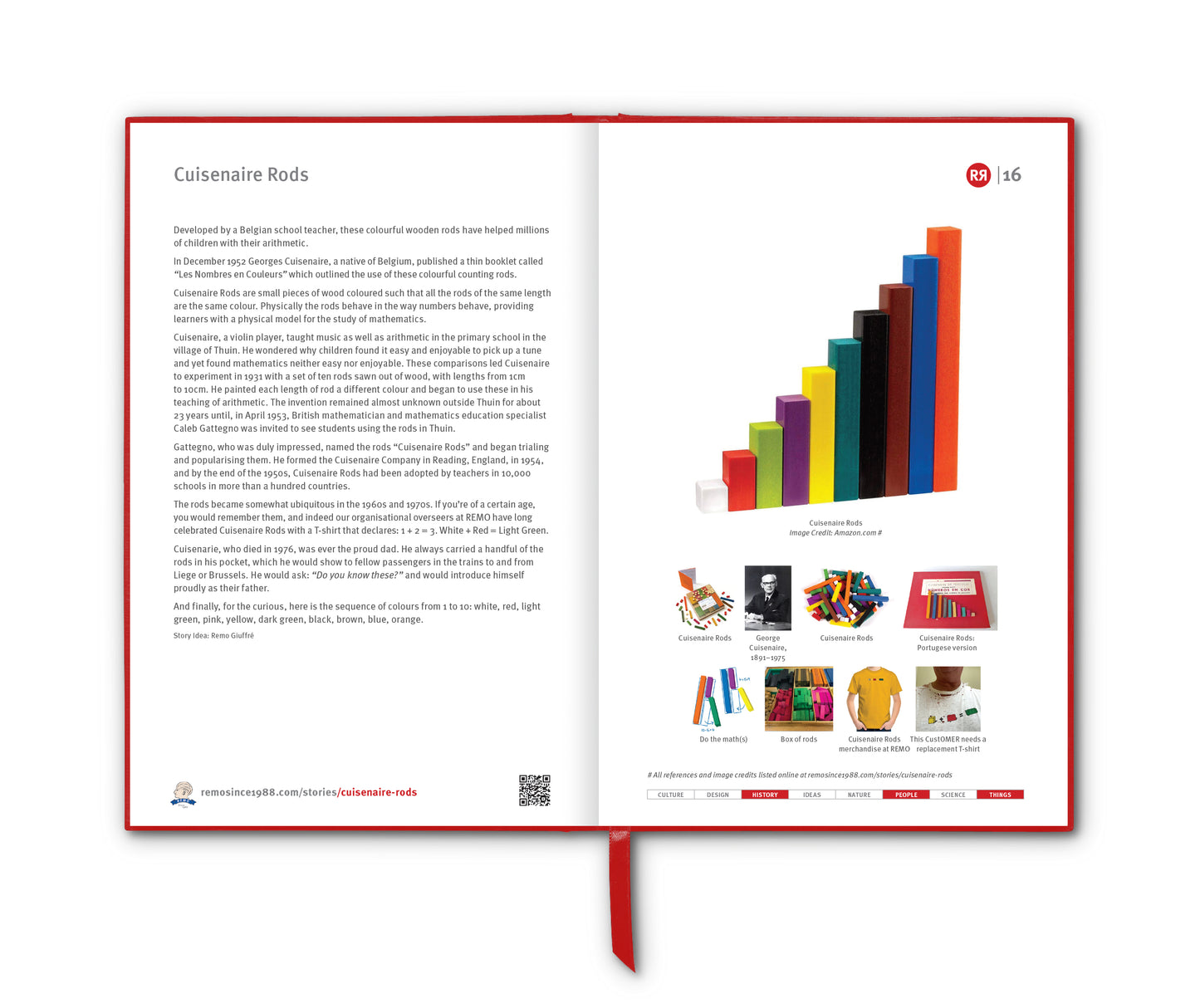
But Maslen’s theory wasn’t merely aesthetic. It plugged into the hopes and anxieties of the colonial era. A great inland sea would mean fertile lands, easier travel and plentiful resources. It would be, in effect, a shortcut to turning the continent into another North America. Governors, explorers and investors were keen to believe. After all, what lay beyond the Blue Mountains was still largely a blank space, and a “sea” was as plausible as anything else.
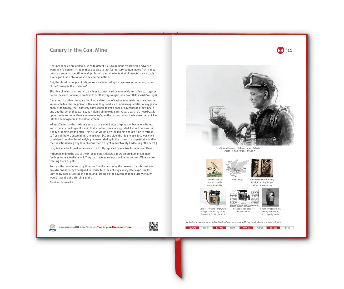
This belief shaped real expeditions. The legendary explorer Charles Sturt, convinced that a large internal body of water must surely exist, led arduous treks into the interior in the 1820s and 1830s searching for it. He found not water but desert, salt pans, mirages and punishing heat – though he remained convinced that he had simply missed the sea. Sturt’s reports didn’t weaken the myth; they added a kind of heroic momentum to it.
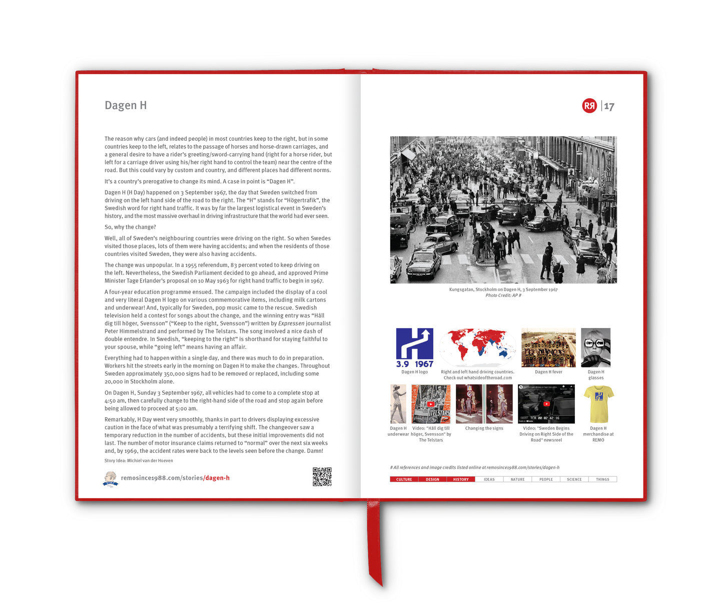
Reality, when it finally asserted itself, did so slowly. As more expeditions charted the inland, the “sea” gave way to an even stranger truth: Australia’s centre was not wet but dry, not fertile but harsh, a place defined not by lakes but by ephemeral rivers, stony plains and salt flats. The closest thing to Maslen’s dream – Kati Thanda-Lake Eyre — does occasionally fill, but rarely and unpredictably.
Maslen’s inland sea is now recognised as a fascinating fever dream: a reminder of how the unknown invites projection, how maps reflect psychology and wishful thinking as much as they do geography – and how powerful a tidy idea can be.
Postscript
Maslen can probably lay claim to one eventuality. He was the first to recommended that camels would be the most suitable form of transport for exploring the interior of Australia and this proved to be correct in later years.
____________________
References
rgssa.org.au/heritage/treasures/maslen-thomas-john-friend-of-australia-1830
addastories.org/the-inland-sea
Images
1 & 2. Maslen's map of Australia, 1827 that appeared in The Friend of Australia, 1830
3. The Friend of Australia, 1830
4. Maslen's plan for a town
5. Great Lakes of United States
6. Composite Landsat 7 satellite image of Kati Thanda-Lake Eyre taken in 1999
7. Maslen proposed camels for exploration. [Ed: Finally, a win!]